
Status
On this page:
In 2012, an assessment of the character and significance of landscapes throughout the South West of Victoria was completed.
The South West landscape assessment study provides a unique insight into, and detailed description of, local landscape values and their contribution to the economic social and environmental significance of the region.
Background
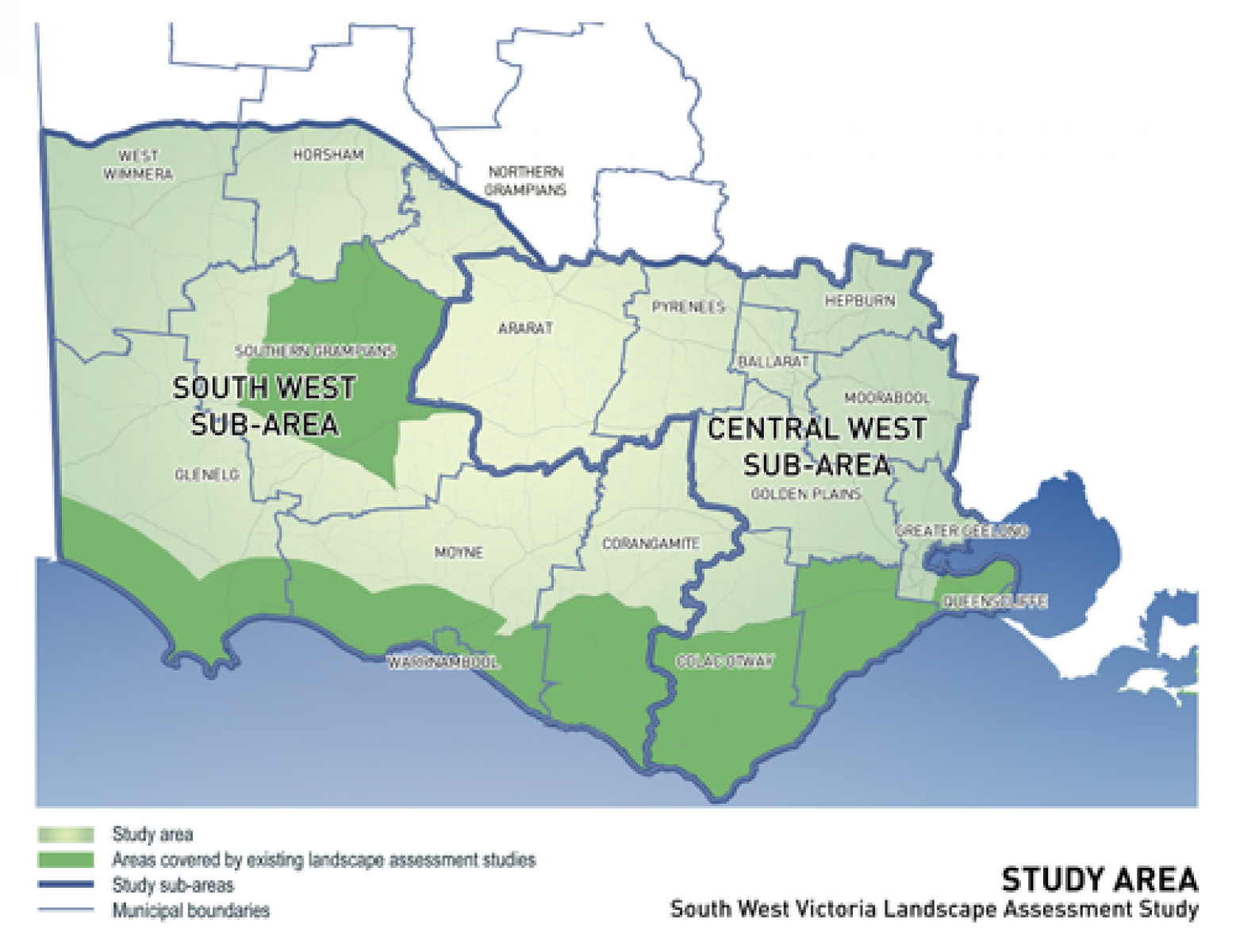
Study area
The study area comprised all non-coastal, non-urban areas in the South West region of Victoria – from Port Phillip Bay in the east to the South Australian border in the west, and extending to the Great Dividing Range in the north. This area includes 15 municipalities. The study complements recent landscape assessment studies that have been undertaken in the region.
Aims of the study
The landscape assessment study aimed to:
- define and describe (with photos and maps) the landscape character of the South West region
- determine which places, features and views are most significant and why
- include the community's values on the character and significance of the landscape
- evaluate various forms of development that have occurred in the landscape, both positive and negative
- consider using policies and guidance in the local planning schemes, such as the significant landscape overlay, to protect and manage the landscape into the future.
The outcomes of the study informed a number of regional growth plans prepared in the region. It provides recommendations and planning scheme-ready policy for retaining and respecting landscape values.
A regional perspective
The regional overview report provides an executive summary of the region's landscape character types, and significant landscape areas and views. The report outlines the methodology used for the study and contains the key recommendations for protecting and managing these landscapes at a state and regional level.
The study presents recommendations about how significant landscape areas and views can be protected from inappropriate development, and better managed into the future. This will help ensure that they continue to contribute to the region's social, environmental and economic values.
We continue to work in partnership with local councils to incorporate recommendations into the relevant planning schemes, and as part of the ongoing implementation of Regional Growth Plans across the state.
Significant areas and views
Landscapes are significant to different people for different reasons. The reasons vary from bring admired for their scenic beauty, to the historic value, the environmental qualities, and/or the value to the regional economy and other less tangible values associated with the place, such as memories or associations.
The study used three main sources of information in the first instance to define investigation areas and to identify their values. These include:
- detailed field surveys
- review of available research material
- community feedback.
How have significant areas and views been assessed?
Levels of significance (state or regional) have been professionally assessed for both landscape areas and views taking into consideration how iconic, exemplary and/or scarce they are, and the cumulative weight of evidence detailing the above cultural values. In addition, views have been assessed based on their composition (both structure and quality) and consideration of their cultural landscape values.
Landscape analysis papers
Landscape analysis papers have been prepared for each area and view assessed as being of state or regional significance.
Each paper includes:
- overall significance rating
- visual assessment, describing in detail the features, edges, contrasts and composition of the landscape.
- other cultural landscape values (for example historic, environmental, social)
- a map of each significant landscape area and view.
Understanding landscape character of the South West
What is landscape character?
Landscape character is consists of a site's geology, topography, vegetation, water bodies and other natural features, combined with the effects of land use and built development.
Landscape character type and area analysis papers
The report includes papers for the region's various character types – western volcanic plains, volcanic lakes and swamps, uplands, the Goldfields, the rolling tablelands, the Wimmera plains, the Grampians and surrounds, vegetated rises, and the Glenelg Plains.
The information within each document includes:
- Overview – Location and key features
- Pattern of viewing – How the landscape is viewed, key lookout points and viewing corridors
- Landscape values – Places, views and features that are valued in the area, as identified through research and community feedback
- Change in the landscape – How the landscape has evolved to its present condition
- Future landscape character directions – A vision for the landscape in the future, and the opportunities and threats to achieve this vision
- Landscape protection and management – Existing planning scheme policies and controls, and objectives for the management of the landscape
Community feedback
Throughout the Study a broad cross section of people and community groups provided information and feedback on landscapes throughout the region. This consultation allowed us to:
- better understand and determine perceptions and values in relation to landscape character
- determine perceptions and values to help identify the most significant landscape areas and views in the study area.
Other landscape assessment studies
The study seeks to integrate previous and current landscape assessment studies undertaken across the region. These include:
- Great Ocean Road Region Landscape Assessment Study, 2003
- Coastal Spaces Landscape Assessment Study, 2006
- Landscape Assessment North of the Princes Highway, Surf Coast Shire, 2007
- Draft Warrnambool Coastal Landscape Review, 2009
- Southern Grampians Significant Landscape Assessment
Page last updated: 09/06/23